New active travel map launched for Cork commuters
A comprehensive map detailing newly developed walking and cycling routes across the eastern Cork metropolitan area has been released. The initiative aims to provide safer, greener transport alternatives connecting residential communities with local amenities and transport hubs.
•
⏱️ 1 min read
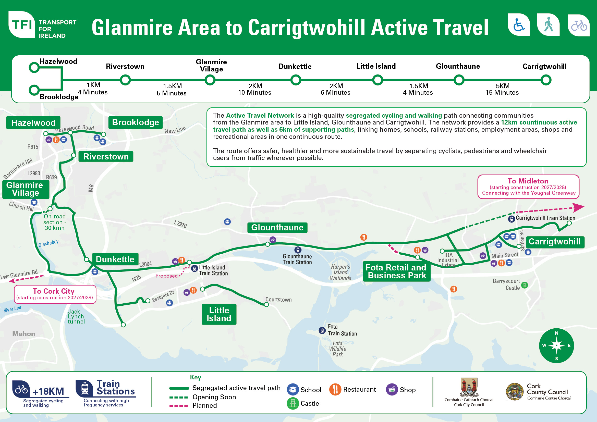
The National Transport Authority, working alongside Cork City Council and Cork County Council, published a comprehensive Active Travel map highlighting an expanding network of pedestrian and cycle paths across Glanmire, Little Island, Glounthaune and Carrigtwohill. This collaborative initiative showcases vital infrastructure developments designed to encourage sustainable commuting and recreational journeys throughout the region.
Central to the publication is a continuous 12km segregated route, complemented by an additional 6km of connecting pathways delivered in recent years. Funded by the National Transport Authority, these engineering schemes aim to offer safer and more convenient alternatives to car travel for residents navigating towards local schools, workplaces, rail stations and commercial hubs.
Local authorities have emphasised that these projects form a crucial part of the broader strategy to revitalise community spaces and promote healthier lifestyles across the eastern Cork metropolitan area. Further details and updates regarding ongoing route expansions are available on the official website.
0 views